cairngorms national park pocket map
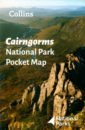
Cairngorms National Park Pocket Map
Handy little full colour map and guide of Cairngorms National Park. Detailed mapping and visitor information to the National Park along with a selection of photographs. Map at a scale of 1:182,000 (2.9 miles to 1 inch or 1.82 km to 1 cm). This small map with additional text and photographs gives a great overview of the Cairngorms National Park, and is the perfect companion for exploring this beautiful area of the Scottish Highlands. Clear, detailed mapping Key park, tourist and travel information Ideal for planning visits to the National Park Index to help locate and plan your trip
748 Руб.
НАЙТИ ЕЩЕ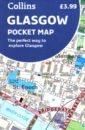
Glasgow Pocket Map
Handy little full colour Collins map of central Glasgow with a high level of detail. Clear mapping from the park of Glasgow Green to the bustling West End. Map at a scale of 1:8200 (7.5 inches to 1 mile). Clear, detailed, full colour Collins mapping is presented in a handy format ideal for the pocket or handbag. It is excellent value and covers the most visited area of central Glasgow. It is an essential buy for tourists and residents alike. This map includes: * Detailed central area map * Around Glasgow map extending to airport, Pollok Park and Strathclyde Park * Tourist locations * Train and bus stations * Listing of major places to visit * Detailed street index
748 Руб.
НАЙТИ ЕЩЕ
Africa. The Highest Peaks. 1:150 000
This trekking map includes the African peaks that are most popular among avid mountain hikers: Mount Kilimanjaro, Mount Kenya and the Rwenzori Mountains. It covers areas in Kenya, Tanzania and Uganda. A large-scale map with rich tourism content will allow you to plan your trek in detail. Our maps are laminated and easy to fold (due to the Comfort! Map technology), which makes them exceptionally handy even in the harshest mountain weather. Map characteristics: - rich tourism content (including trekking routes, tourist infrastructure, natural attractions and other sights of tourist interest), - exhaustive topographic information (on the roads, hydrographic features, farmlands, forests, glaciers etc., given in extended nomenclature), - shaded relief, representing the area's three-dimensional topography, - GPS compatibility (WGS84 geographic coordinates), - map legend in six languages: English, German, French, Spanish, Italian and Polish. The title comprises maps of the following regions: - Kilimanjaro National Park and Arusha National Park (1:150 000), - area around the Kibo summit of Mount Kilimanjaro (1:50 000), - volcanic massif of Mount Kenya (1:175 000), - top of Mount Kenya - Batian & Nelion (1:50 000), - Rwenzori Mountains National Park (1:100 000), - highest peaks of the Rwenzori Mountains - Margherita & Alexandra (1:50 000). Map legend in six languages: English, German, French, Spanish, Italian and Polish.
2319 Руб.
НАЙТИ ЕЩЕ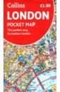
London Pocket Map. The Perfect Way to Explore London
Handy little full colour map of central London with a high level of detail. Clear mapping from Regent's Park in the north to Kennington in the south, and Kensington Gardens in the west to Tower Bridge in the east at a scale of 1:12,500 (5 inches to 1 mile). Maps of West End shopping and theatres are also included. Mapping is presented in a handy format ideal for the pocket or handbag. It is excellent value and covers the most visited area of central London. It is an essential buy for tourists and residents alike. Includes Detailed central area map Map of theatres and cinemas Shopping map Underground map The latest congestion zone boundary
574 Руб.
НАЙТИ ЕЩЕ
London A-Z Street Atlas
Navigate your way around London with this detailed, easy-to-use and up-to-date A-Z Street Atlas. First published in 1936, this iconic atlas is a trusted means of finding your way around the capital city. The main mapping extends beyond Central London from Heathrow Airport to Chingford at a scale of 2.88 inches to 1 mile, featuring postcode districts, one-way streets, the Congestion Charging Zone and Low Emission Zone. The large-scale street map of Central London – at a scale of 5.75 inches to 1 mile – cover Regent’s Park and Shoreditch, Chelsea and Vauxhall, Hyde Park and Bermondsey. A comprehensive index lists streets, selected flats, walkways and places of interest, place, area and junction names. Additional healthcare (hospitals, walk-in centres and hospices) and transport connections (National Rail, London Tramlink, Docklands Light Railway, London Underground and Overground stations, and River Bus pier) are indexed as well. Also included are: • Overview map of the Congestion Charging Zone • West End Theatre map • London Connections rail services map • London Underground map
1310 Руб.
НАЙТИ ЕЩЕ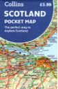
Scotland Pocket Map
Handy little full colour map of Scotland. Excellent value and very detailed for its size. Double-sided folded map with the Central Belt, southern Scotland and northern England on one side and northern Scotland including Orkney and Shetland on the reverse. This map features: * Clear mapping at a scale of 8.7 miles to 1 inch * National Tourist Routes showing best routes through the most scenic areas * Top 100 places of interest * Park and Ride locations * Ideal companion to a sat-nav - it enables route planning and route sense-checking Essential for those planning a trip or who want an inexpensive and easy-to-use back up for a sat-nav.
748 Руб.
НАЙТИ ЕЩЕ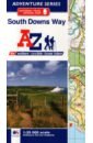
South Downs Way National Trail Official Map
The A-Z Adventure Series of maps combines the best of OS and A-Z, creating the perfect companion for walkers, off-road cyclists, horse riders and anyone wishing to explore the great outdoors. The South Downs Way is a National Trail along the chalk escarpments and ridges of the South Downs. This undulating path begins in Winchester and finishes in Eastbourne covering 100 miles (160km) and lies completely within the South Downs National Park. The route on the map is clearly highlighted in yellow with mileage markers to gauge distances when planning sections of the walk to enjoy. This official National Trail Map* of the South Downs Way features 44 pages of continuous Ordnance Survey 1:25000 mapping providing complete coverage of the South Downs Way. This atlas includes a route planner showing distances between places and the amenities available, featuring: Campsites (seasonal opening) Information Centres Hotels/B&Bs Youth Hostels Public Houses Shops Restaurants Cafes (seasonal opening) Petrol Stations Also featured is advice on safety and security when walking and a selection of QR codes linked to useful websites, including temporary route updates from the National Trails, regional information, map reading advice and weather reports. Unlike the original OS sheets, this A-Z Adventure Atlas includes a comprehensive index to towns, villages, hamlets and locations, natural features, nature reserves, car parks and youth hostels, making it easy to find the required location quickly. Each index entry has a page reference and a six figure National Grid Reference. With a book size of 240mm x 134mm it is the same size as a standard folded OS map. Other National Trails available within the A-Z Adventure series include: Cotswold Way, Hadrian's Wall Path, North Downs Way, Offa's Dyke Path, Pembrokeshire Coast Path, Pennine Way, SW Coast Path, Thames Path and The Ridgeway.
1678 Руб.
НАЙТИ ЕЩЕ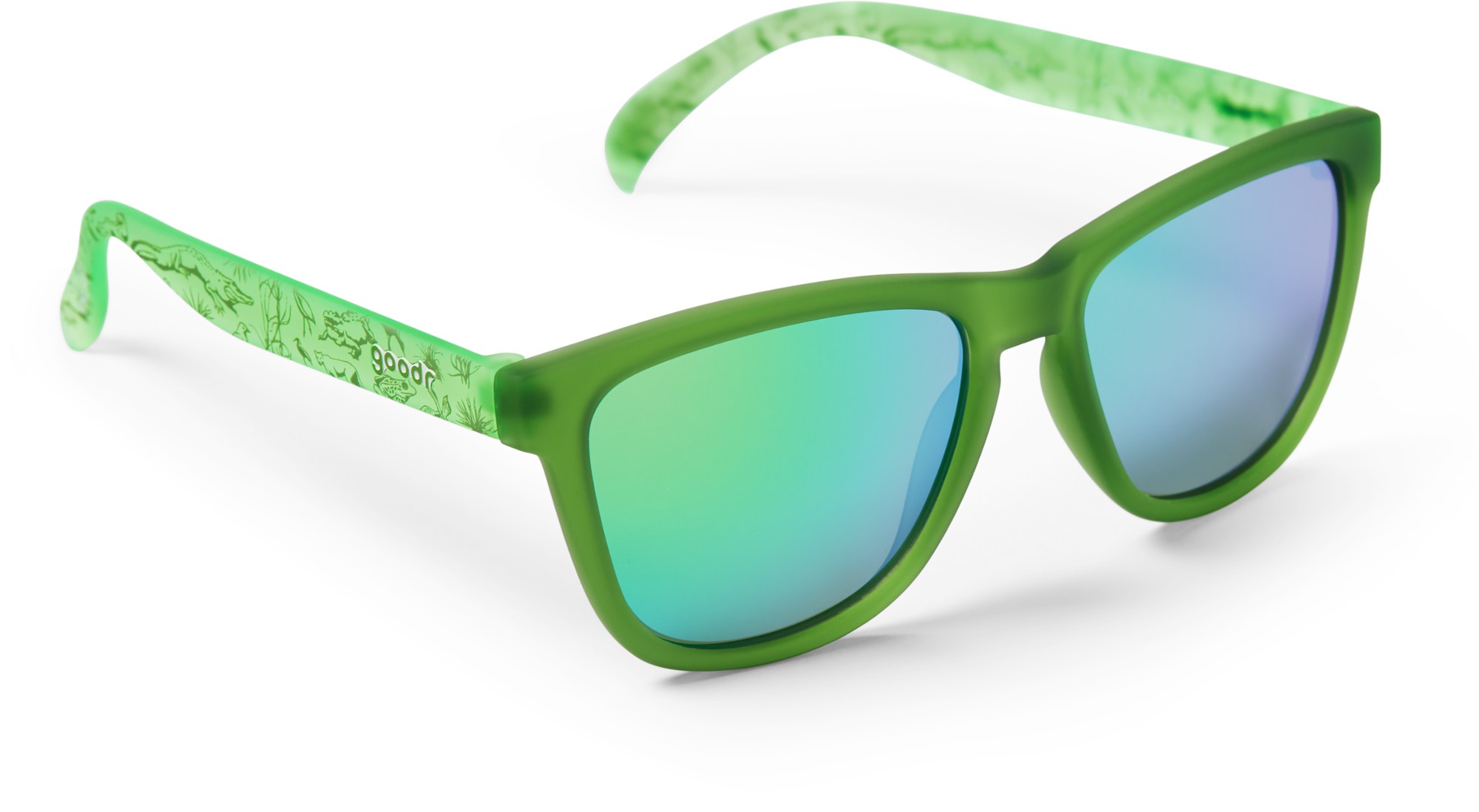
Поляризованные солнцезащитные очки национального парка Эверглейдс goodr, зеленый
Поляризационные солнцезащитные очки Goodr National Park Everglades National Park подходят для пеших прогулок, езды на велосипеде, каякинга, скалолазания и набивания еды в лицо. Они станут вашим любимым местом для прогулок и игр.
5496 Руб.
НАЙТИ ЕЩЕ
Alaskan Ice Climbing
Many people visit Alaska to see the beautiful national parks. One group of visitors wants to fly into a national park and go skiiing. However, the weather turns bad. Will the visitors be able to get to the park? What will they do there?
601 Руб.
НАЙТИ ЕЩЕ
Everglades National Park
Four articles linked together by the topic of Everglades National Park.
897 Руб.
НАЙТИ ЕЩЕ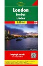
London. 1:10 000
Explore London downtown with this Freytag & Berndt street map. The best way to plan your trip, prepare your itinerary, and to travel independently in the British capital. This map covers: from Kensington Park to the Tower of London (west/east), and from Regent's Park to Battersea Park (north/south). Street index on the other side. Touristic information: pesdestrian streets, parks, theatres, museums, religious buildings, monuments, World Heritage sites, police stations, hospitals, tourist centres, post offices, underground, bus terminal. The legend is in English, German, French, Italian, Dutch, Spanish, Czech, Slovak, Polish and Hungarian.
937 Руб.
НАЙТИ ЕЩЕ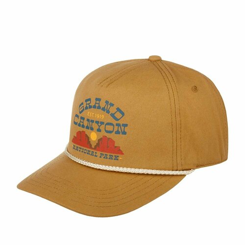
Бейсболка American Needle, размер OneSize, коричневый
Бейсболка Grand Canyon National Park Canvas от культового бренда American Needle. Модель выполнена из хлопка рыжего оттенка. На мягкой передней панели - матовая печать с надписью Grand Canyon est. 1919/National Park и символическим изображением парка. «Большой Каньон» - одна из самых популярных природных достопримечательностей США. Максимальная глубина Большого каньона достигает 1,8 км, а ширина – 29 км. Место между передней панелью и козырьком декорировано бежевым шнурком. Изнанка козырька - серая. Размер бейсболки регулируется с помощью пластиковой застежки. Для вентиляции предусмотрены люверсы. Длина козырька – 7 см, глубина бейсболки – 12 см. Для комфортной посадки внутри предусмотрена встроенная сеточка в области передней панели, а также лента, на ней – нашивка American Needle National Park Collection.
4589 Руб.
НАЙТИ ЕЩЕ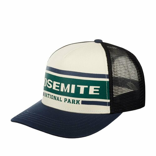
Бейсболка American Needle, размер OneSize, синий
Бейсболка с черной гладкой сеточкой Yosemite National Park Sinclair от культового бренда American Needle. Модель с чуть изогнутым козырьком выполнена из хлопка и полиэстера. На передней твердой панели - матовая печать с надписью YOSEMITE National Park. Национальный парк «Йосемити» – это первый национальный парк Калифорнии, организованный в 1890 году. Эта уникальная экологическая система, включенная в Список Всемирного наследия юнеско, может похвастаться дремучими лесами, неповторимыми утесами из гранита и самым высоким водопадом в США. Пуговка на макушке и козырек - темно-синие. Размер бейсболки регулируется с помощью пластиковой застежки. Для вентиляции предусмотрены люверсы. Для комфортной посадки внутри предусмотрена лента, на ней – нашивка American Needle National Park Collection. Длина козырька – 7 см, глубина бейсболки – 12 см.
4589 Руб.
НАЙТИ ЕЩЕ
Шапка бини Lyle & Scott
Бренд: Lyle & ScottЦвет: cairngorms khaki
5058 Руб.
НАЙТИ ЕЩЕ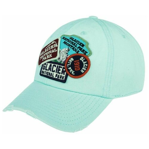
Бейсболка American Needle, размер UNI, голубой
Американская бейсболка GLACIER NATIONAL PARK из серии Iconic. Бейсболка сшита из состаренного светло-голубого хлопка. На передней панели – четыре винтажные нашивки с названием Национального парка США - Глейшер (Glacier National Park), основанного в 1910 году. Для усиления винтажного эффекта края козырька порваны и потрепаны. Размер бейсболки регулируется с помощью текстильного ремешка с металлической пряжкой. Для вентиляции предусмотрены люверсы. Длина козырька – 7 см, глубина бейсболки – 11 см.
5394 Руб.
НАЙТИ ЕЩЕ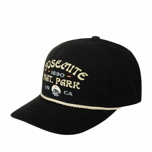
Бейсболка American Needle, размер OneSize, черный
Черная бейсболка Yosemite National Park Canvas Cappy от культового бренда American Needle. Модель с чуть изогнутым козырьком выполнена из бархатистого хлопка. На передней мягкой панели - матовая печать с надписью Yosemite National Park 1890 и изображением горной вершины. Национальный парк Йосемити – это первый национальный парк Калифорнии, организованный в 1890 году. Эта уникальная экологическая система, включенная в Список Всемирного наследия юнеско, может похвастаться дремучими лесами, неповторимыми утесами из гранита и самым высоким водопадом в США. Место между передней панелью и козырьком декорировано бежевым шнурком. Для вентиляции предусмотрены люверсы. Для комфортной посадки внутри предусмотрена встроенная сеточка в области передней панели, а также лента, на ней – нашивка American Needle National Park Collection. Длина козырька – 7 см, глубина бейсболки – 12 см.
4589 Руб.
НАЙТИ ЕЩЕ