scotland pocket map
Scotland Pocket Map
Handy little full colour map of Scotland. Excellent value and very detailed for its size. Double-sided folded map with the Central Belt, southern Scotland and northern England on one side and northern Scotland including Orkney and Shetland on the reverse. This map features: * Clear mapping at a scale of 8.7 miles to 1 inch * National Tourist Routes showing best routes through the most scenic areas * Top 100 places of interest * Park and Ride locations * Ideal companion to a sat-nav - it enables route planning and route sense-checking Essential for those planning a trip or who want an inexpensive and easy-to-use back up for a sat-nav.
806 Руб.
НАЙТИ ЕЩЕ
Scotland Touring Map
Explore new places with this up-to-date map of Scotland. Bestselling map of Scotland. More than 1,000 places of tourist interest plotted and named on the map. The features have been plotted onto an up-to-date and attractive Collins map of Scotland. A clear, easy to follow road map with colour classified roads. Ideal for tourists with hundreds of distinctive tourist symbols and tourist information centres all shown. This map includes: * The whole of Scotland on a double sided sheet at 5 miles to 1 inch * Over 25 categories of tourist information shown on the map including youth hostels, picnic sites and ferries as well as the more obvious tourist sites such as castles, wildlife parks and museums * Detailed town centre maps of Edinburgh, Glasgow, Aberdeen, Dundee, Inverness and Perth * New places of interest including Japanese Garden (near Dollar), Macallan Distillery centre, Moat Brae (Dumfries) and Scottish submarine centre (Helensburgh) * Road updates include the new Dalry bypass, Maybole bypass under construction, A9 dualling sections * New stations of Robroyston and Kintore Scale: 1:316,800 (5 miles to 1 inch). There is a comprehensive index to both place names and places of tourist interest.
990 Руб.
НАЙТИ ЕЩЕ
Great Britain. Ireland. 1:700 000
Explore Great Britain & Ireland with this Freytag&Berndt double-sided road map. The best way to plan your trip, prepare your itinerary, and to travel independently in England, Scotland, Wales, Man, Northern Ireland and the Republic of Ireland.
937 Руб.
НАЙТИ ЕЩЕ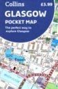
Glasgow Pocket Map
Handy little full colour Collins map of central Glasgow with a high level of detail. Clear mapping from the park of Glasgow Green to the bustling West End. Map at a scale of 1:8200 (7.5 inches to 1 mile). Clear, detailed, full colour Collins mapping is presented in a handy format ideal for the pocket or handbag. It is excellent value and covers the most visited area of central Glasgow. It is an essential buy for tourists and residents alike. This map includes: * Detailed central area map * Around Glasgow map extending to airport, Pollok Park and Strathclyde Park * Tourist locations * Train and bus stations * Listing of major places to visit * Detailed street index
748 Руб.
НАЙТИ ЕЩЕ
Scotland A-Z Visitors' Atlas and Guide
This A-Z Map of Scotland is a full colour visitors' atlas and guide combining detailed road mapping, at 3 miles to 1 inch, with an illustrated town plan section, providing a feature rich, informative and helpful tourist guide. Contents include: 64 pages of road mapping covering the whole of Scotland, including the Inner and Outer Hebrides and the Orkney and Shetland Islands Index to cities, towns, villages, hamlets and major destinations A comprehensive index to places of interest with corresponding map symbols shown alongside for quick identification 20 city and town plans with background text, tourist information and leisure attraction details: Aberdeen Aviemore Ayr Dumfries Dundee Dunfermline Edinburgh, large scale map and street index Glasgow, large scale map and street index Falkirk Fort William Hamilton Inverness Kilmarnock Kirkcaldy Motherwell Oban Paisley Perth St. Andrews Stirling Instantly recognizable and easy to use, A-Z mapping includes the following features: -Clear standard road classification colours for easy identification -Full motorway junction detail -Under construction and proposed roads -Primary route destinations -Service Areas -A wide range of tourist attractions and ancillary information Selected fuel stations. National and county boundaries This Scotland Visitors' Atlas and Guide is the ideal publication with which to explore Scotland's bustling towns and cities or enjoy the spectacular and tranquil landscape this beautiful country has to offer.
1577 Руб.
НАЙТИ ЕЩЕ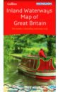
Inland Waterways Map of Great Britain
The bestselling guides to Britain's canals and rivers for 50 years. The map companion to the Collins Nicholson Waterways Guides, covering the entire network of canal and river navigations in England, Scotland and Wales, including newly restored/opened canals and rivers. The map identifies: - narrow and broad canals; - navigable rivers; - tidal river navigations; - waterways under construction. Also: - contact telephone numbers and dimensions for each waterway - internet links Clear insets of the Birmingham Canal Navigations, Scottish inland waterways, the Norfolk Broads and the London area.
1498 Руб.
НАЙТИ ЕЩЕ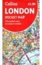
London Pocket Map. The Perfect Way to Explore London
Handy little full colour map of central London with a high level of detail. Clear mapping from Regent's Park in the north to Kennington in the south, and Kensington Gardens in the west to Tower Bridge in the east at a scale of 1:12,500 (5 inches to 1 mile). Maps of West End shopping and theatres are also included. Mapping is presented in a handy format ideal for the pocket or handbag. It is excellent value and covers the most visited area of central London. It is an essential buy for tourists and residents alike. Includes Detailed central area map Map of theatres and cinemas Shopping map Underground map The latest congestion zone boundary
574 Руб.
НАЙТИ ЕЩЕ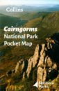
Cairngorms National Park Pocket Map
Handy little full colour map and guide of Cairngorms National Park. Detailed mapping and visitor information to the National Park along with a selection of photographs. Map at a scale of 1:182,000 (2.9 miles to 1 inch or 1.82 km to 1 cm). This small map with additional text and photographs gives a great overview of the Cairngorms National Park, and is the perfect companion for exploring this beautiful area of the Scottish Highlands. Clear, detailed mapping Key park, tourist and travel information Ideal for planning visits to the National Park Index to help locate and plan your trip
806 Руб.
НАЙТИ ЕЩЕ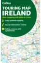
Collins Ireland Touring Map
Explore new places with handy pocket maps from Collins. Large full colour map of the whole of Ireland showing the road network in detail, and with a special emphasis on places of tourist interest. This map has a handy touring scale of 7.5 miles to 1 inch (1:475,200). It has more than 20 categories of tourist information depicted clearly on the map. There is a full index to place names and places of interest. This map includes: * All classified and most minor roads * Railway network and ferry routes * Viewpoints and sandy beaches * Speed enforcement zones and safety camera locations * Index to 20 categories of tourist information * Includes castles, historic houses, gardens, beaches and golf courses
1123 Руб.
НАЙТИ ЕЩЕ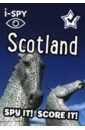
I-Spy Scotland. Spy It! Score It!
Explore Scotland with i-SPY – facts, photos and fantastic spots! Beat the boredom and take time out from screens with this pocket-sized book packed with facts, photos and fantastic spots for hours of fun! It’s ideal for holidays, family road trips or simply exploring your local area. Kids will have fun collecting points with more than 140 things to find in Scotland. From mountains and lochs to landmarks and attractions, they’ll learn all about the country and its history along the way. And once they’ve scored 1000 points, super-spotters can claim their official i-SPY certificate and badge.
806 Руб.
НАЙТИ ЕЩЕ
Scotland - North England. 1:400 000
Explore Scotland and North England with this Freytag&Berndt double-sided geographical and road map. The best way to plan your trip, prepare your itinerary, and to travel independently in this part of Great Britain. Place name index. Touristic information: places of interest, airports, castles, manor-houses, religious buildings, archaeological sites, campgrounds, monuments, golf-courses. The legend is in English, German, French, Italian, Spanish, Dutch, Polish, Czech, Hungarian, and Slovak.
937 Руб.
НАЙТИ ЕЩЕ
Stevenson Robert Louis Treasure Island
Part of Penguin's beautiful hardback Clothbound Classics series, designed by the award-winning Coralie Bickford-Smith, these delectable and collectible editions are bound in high-quality colourful, tactile cloth with foil stamped into the design. The story grew out of a map that led to imaginary treasure, devised during a holiday in Scotland by Stevenson and his nephew. The tale is told by an adventurous boy, Jim Hawkins, who gets hold of a treasure map and sets off with an adult crew in search of the buried treasure. Among the crew, however, is the treacherous Long John Silver who is determined to keep the treasure for himself. Stevenson's first full-length work of fiction brought him immediate fame and continues to captivate readers of all ages.
4054 Руб.
НАЙТИ ЕЩЕ
Путеводитель Amsterdam InsightExplore
Practical, pocket-sized, packed with inspirational insider information, and a focus on Best Route walking tour itineraries, this series is an ideal on-the-move companion to top international destinations. All Explore Guides come with a free eBook. Large pull-out map provides an area overview and each Best Route is accompanied by a detailed full-colour map High-production values - smart compact format and full-colour throughout. Concise insider information about landscape, history, food and drink, and entertainment options. Directory provides invaluable insight into top accommodation, restaurant and nightlife options by area, along with an overview of language, books and films.
869 Руб.
НАЙТИ ЕЩЕ
Ascherson Neal The Death of the Fronsac
A Story of Sabotage, Betrayal and the Terrible Sadness of Exile. Scotland, 1940: The Fronsac, a French warship, blows up in the Firth of Clyde. The disaster is witnessed by three locals. Jackie, a young girl who thinks she caused the explosiong by running away from school. Her mother Helen, a spirited woman married to a dreary young officer; and their lodger, a Polish soldier whose country has just been erased from the map by Hitler and Stalin. All their lives will be changed by the death of the Fronsac.
2106 Руб.
НАЙТИ ЕЩЕ
Fischer Joachim Vienna. Architecture & Design
200 color photographs and Plans. Text in English, German, French and Spanish. Vienna's once exalted status as the showpiece of an empire is reflected in the elegance and monumentality of its architecture. But behind and beyond the stately facades, design innovations are transforming interiors and resulting in exciting new residential and commercial buildings being constructed at the city's edges. This user-friendly little guide profiles some of the most notable projects built during the last few years and includes color photographs and a site map. Another in teNeues' authoritative series of pocket guides to recent architecture in cities around the world. Includes color photographs and a site map for easy use by tourists and professionals alike.
614 Руб.
НАЙТИ ЕЩЕ